
As a land manager, it is important to read land deeds and to be confident that those deeds correctly describe what is owned on the ground.
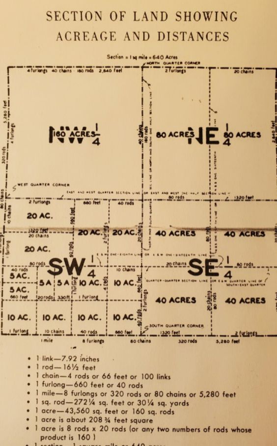
Alabama lands were long ago surveyed into grids of Sections, Townships, and Ranges. Each Township holds 36 Sections. All deeds and maps should refer to how your property fits into that grid.
Your deed may describe distances in rods or chains rather than feet or yards. Foresters “pace” (estimate distance while walking) in chains. One chain is 66 feet and a Section is an 80 chain square of 640 acres.
When a forester reads that your land is West Half of SE1/4 of Section 20, Township 21 North, Range 25 East, they know exactly where to find it. ..in theory. But in reality, not all Sections are exact squares, not all landowners correctly mark their property lines, and not all surveyors have divided the sections into parcels accurately.
A boundary line survey measures the exact distances and directions of each property line. Still, a survey is worth little if adjoining neighbors do not agree with it.
Is it time to review your deeds, walk your lines, and confirm what you own and pay taxes on? Call FCI to assist!